
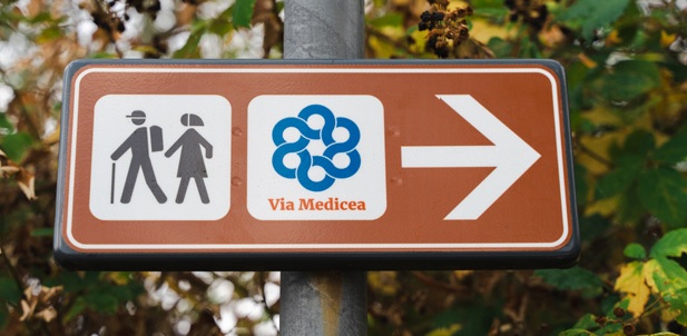
With a total length of 106 km, it winds through a historically diverse and complex territory. It enters with the declared intent of understanding it and making it known to the walker who travels it. It is the Via Medicea, the name of the route that begins at the Cascine Medicea di Tavola (Prato) and, after passing through the municipalities of Poggio a Caiano, Carmignano, Montelupo Fiorentino, Quarrata, Vinci, and Cerreto Guidi, ends in Fucecchio, near the Rocca Corsini, connecting to the Via Francigena and crossing eight municipalities and three different provinces (Prato, Pistoia, and Florence). For a moderately trained walker, it takes four to five days to complete the entire route.
The area traversed by the Via Medicea includes Montalbano and the two large plains lying at its foot, to the northeast and southwest; During the Middle Ages, this area saw the formation of a distinct territorial cluster, clustered around fortified towns. Thanks to its constant contact with larger communities such as the four cities at its gates (Florence, Prato, Pistoia, and even Pisa, although slightly more distant), it was not characterized as a closed world, but rather open to broader historical, political, and environmental conditions. It should also be remembered that, also in the Middle Ages, Montalbano was a frontier territory with strategic importance and an intense military-territorial vocation; it was, in fact, the place where large noble factions built a large series of military structures that today the Via Medicea passes along its route.
With the end of the Middle Ages and the beginning of the modern era, this territory underwent a radical change, transforming from a military frontier area with a distinct character into a complex territorial system where plains, hills, and the upper part of the mountain
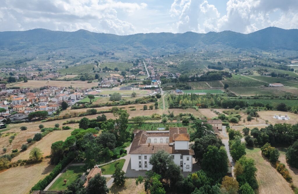
integrated with each other, catalyzing the Medici’s patrimonial and territorial policy. During the 1470s, these families made their appearance, initiating a slow influx of wealth into the area of Poggio a Caiano and the adjacent marshy plain, where the Cascina Laurenziana would later be built—not coincidentally, the starting point of the Via Medicea. This influx subsequently began to ascend the mountainside toward Artimino, continuing along the summit. By the end of the 15th century, the northern slope of Montalbano had already fully responded to the major political transformations that saw the progressive shift to political, territorial, and patrimonial hegemony of the Medici family.
With the modern era, the entire area centered on Montalbano saw the spread of a new, highly significant presence: that of the Prince and his territorial ownership. It was a new way of managing the land, combining traditional sharecropping production (oil, wine, and wheat) with other potential uses (rice and dairy farming) and spaces for celebration and recreation (hunting and exotic animal husbandry). All of these aspects, over a long period from the late 15th century to 1737, left their mark on the territory between Prato and Fucecchio, between Cerreto and Artimino, and as far as the Valdinievole, enabling the construction of a truly new landscape.
The Via Medicea, traversing it, has the task of demonstrating and explaining to the tourist-walker the genesis and development of this centuries-old process, thus providing an interpretative key to deciphering the profound structure of the present-day landscape of Montalbano and the two neighboring plains.
The Via Medicea in the Quarrata area
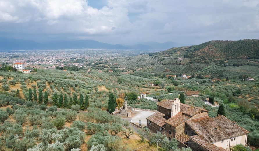
Where the Via Medicea runs along the Montalbano ridge and passes near Sant’Alluccio, a branch road branches off and makes a wide loop, first descending to Fagiana Alta, then passing the Maestrino farm, the church of Buriano, and the village of Tacinaia, descending to Quarrata and heading towards Villa La Magia. From the Villa, passing through the scattered villages of Case Ferretti, Leano, Maccione, the village of Lucciano, and Bracali, it climbs the steep northern slope of Monte Fiore
(on whose summit, in the Middle Ages, there was a large fortress) to reach the ridge again and head towards the enigmatic Sasso di Pietra monolith, then descending to the Empoli plain.
This loop is approximately 15 km long and takes about 4.5 hours to complete (not including stops) and requires some effort due to the significant elevation changes involved, both uphill and downhill. The effort, however, is amply rewarded by the views from the upper section of the route, as you descend toward Pistoia, Serravalle, and the entire Pistoia-Prato Apennine range. But beyond the views, it’s the presence of evident historical and architectural landmarks along the route that characterizes this stretch of the Via Medicea. These landmarks allow us to understand the origins of this territory, long disputed between Pistoia and Florence, and also the formation of its historical landscape, so strongly influenced by its topography (Montalbano first and foremost) and the presence of two cities, Pistoia and Florence, which adapted their respective countrysides to their needs.
Morphology, lithology, water, roads, and historical settlements
It may be helpful for hikers following the Via Medicea from the Montalbano ridge toward Quarrata to examine the history of the landscape in this small strip of land, approximately 1.5 square kilometers, that extends along the upper reaches of three small streams (the Buriano River, the Tacinaia River, and the Pantano or Pontaccio River), behind the municipal capital. This area, starting from the east and moving clockwise, is delimited by the municipal border between Colle and Spazzavento, by the 250-meter isoipsy, by the village of Buriano, and by the Bonto, Paretaio (a highly evocative microtoponym), and Pollaiolo farms, which to the north close this irregularly shaped polygon, traversed by tourists descending along the Via Medicea.
If we compare three images of this territory dating back to 1820 (Leopoldino Land Registry), 1954 (first flight with aerial photos of Tuscany) and 2025 (Maps), interspersing them with the regional cartography at 1:10,000 scale and with the lithological map of Tuscany, we can make some interesting deductions on the evolution that the hilly landscape near Quarrata has undergone over the last two centuries.
The area in question features a rugged hilly morphology characterized by a considerable average gradient (18%), to which must be added the slope of the three watersheds, which, although small, are significantly recessed. This is, in fact, the result of the flow of these three watercourses through the Sillano Formation, the rock from which these hills are composed, which is loose, easily eroded by rainwater, as well as unstable and subject to landslides. The 250-meter altitude represents more or less the altitudinal limit of this Sillano Formation and therefore the point of contact with a much more tenacious rock (Macigno) that characterizes the upper, wooded section of the entire Montalbano. This phenomenon has decisively influenced the history of human settlement, especially in past centuries when technology was unable to circumvent environmental constraints; even today, the landscape in question features an uninterrupted forest cover and much steeper slopes above 250 meters, while below it lies cultivated land.
Lithology is one of the main factors that has determined the history of human settlement. On the hills of Quarrata, man has indeed identified the ‘suitable’ environment for agriculture, but in exchange for a very hard work of adaptation (creation of terraces) and an equally exhausting maintenance effort through the regulation of rainwater with the creation of a dense hierarchical network of ditches, ditch heads and quarries.
If we examine the 19th-century land registry maps, we can see how this small area mentioned above is clearly distinguished from the adjacent one that climbs the slope of Montalbano, due to the significantly smaller size of the parcel here than in the other. This is a visible sign of how our area was organized according to the mixed farming typical of the sharecropping system, which exploited the limited space of the parcel both horizontally and vertically. In this way, there were two levels occupied: the lower one with cereal crops, and the upper one with tree crops, namely vines, olives, and fruit trees.
Medieval historiography has now established that the plebeian districting conformed to the road system and, at the same time, influenced its development by guiding its routes, since the parish churches were public religious buildings and as such had to be easily accessible. Well, the layout of many plebates present on both sides of Montalbano develops in a SW-NE direction, which is orthogonal to that of the mountain (NW-SE), occupying them entirely, from the foothills to the ridge and beyond. Therefore, in the Middle Ages, Montalbano was traversed by a dense transversal network of roads, as evidenced by a series of ecclesiastical institutions with a hospital function located at specific points: the passes (in addition to Sant’Alluccio, see also the abbeys of San Baronto and San Martino and the rectory of San Giusto) and flanks (in addition to the hospital of Tizzana, see also that of San Pietro a Capraia with the adjoining abbey). This reasoning helps us understand how Montalbano was fully included in the pilgrimage routes of the Middle Ages, being able to connect the towns of the Ombrone Valley with the Valdarno di Sotto, the Via Francigena, and the sea.
Text by Paolo Gennai
Drone photo by Lorenzo Marianeschi


